Fireside Picnic Area
The eastern gateway and the gate marking the restricted section; a common cycling start.
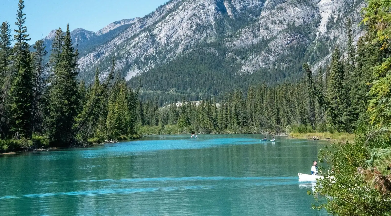
The Bow Valley Parkway is the original road between Banff and Lake Louise. It is slower, quieter and unfenced, and that last word is why it's the best wildlife-viewing drive in the park. It follows the Bow River, the thread that ties this whole landscape together, from the thundering cascade of Bow Falls just outside town all the way up to the postcard sweep of Morant's Curve.
The calendar above is for the Banff e-bike and walking tour in Johnston Canyon (★ 4.7 from 90 reviews on GetYourGuide): a guide leads you out of town past Vermilion Lakes and up the Legacy Trail, along the parkway itself, and then on foot to the Lower Falls bridge in Johnston Canyon, about 26km of riding and 3km of walking in four hours, with a shuttle back to Banff. It isn't suitable for children under 16.
This guide covers both halves of the Bow: the falls you can walk to from downtown, and the 48-kilometre drive that is genuinely the road to take if you want to see a bear.
Bow Falls sits just outside the townsite, where the Bow River sweeps around the base of Tunnel Mountain below the Fairmont Banff Springs, just before the Bow meets the Spray. It's not a tall waterfall, a single drop of about 9 metres (30 feet), but it's a wide, powerful one, roughly 30 metres across. The power is in the breadth and volume, not the height. It roars in the June snowmelt when the river runs high and brown, and quietens to a clearer flow by late summer.
Getting there. There are two easy ways. By car from downtown, cross the Bow River Bridge, turn left onto Spray Avenue, then left onto Bow Falls Avenue following the golf-course signs. A free lot sits right at the viewpoint; it's busy at midday, so go early or late. On foot, follow the Bow River Trail from the south end of Banff Avenue, about 1–2km along the water and one of the nicest short walks in town.
Surprise Corner. High above the falls on Tunnel Mountain Road, this small viewpoint gives you the classic postcard: the Fairmont "castle" rising above the Bow with the falls below. It's one of the most photographed scenes in Banff, and you can reach it on foot from town or by car. Don't climb the steep, unstable cliffs above the falls; Parks Canada warns against it for good reason. Without a car, the Banff wildlife and sightseeing minibus tour stops at both Bow Falls and Surprise Corner on its morning loop.
Movie fame. Bow Falls had its Hollywood moment in the 1953 filming of River of No Return, the Otto Preminger Western with Marilyn Monroe and Robert Mitchum, based out of the Banff Springs. A raft went over the falls in the climactic scenes, and Monroe injured her ankle working on the river.
Wildlife. The riverbanks and the adjacent golf course are reliable for elk, especially in spring and fall, and the corridor draws waterfowl, the occasional eagle or osprey and, because this is still bear country, the occasional bear. Carry bear spray even on this paved, in-town trail.
The Bow is the connective tissue of the whole landscape. It rises from the Bow Glacier and turquoise Bow Lake high on the Icefields Parkway (a stop on the Columbia Icefield and Skywalk tour), then flows southeast past Lake Louise, through Banff (where the Spray joins), out past Canmore, through Calgary, and across the prairies for about 587km before joining the Oldman River. Its water ultimately drains to Hudson Bay.
The name translates an Indigenous reference to the reeds along its banks, used to make bows and arrows. In Blackfoot it's Makhabn, "river where the bow reeds grow"; the Stoney Nakoda name means "a place where people made bows." The Blackfoot Confederacy, Stoney Nakoda and Tsuut'ina have lived in this watershed for thousands of years.
Ecologically, the Bow's riparian corridor is one of the richest habitats in the mountain parks: a low, warm, productive valley bottom that acts as a critical east-west wildlife travel corridor. It supports waterfowl, bald eagles, ospreys, herons, beavers, otters and native trout, and the surrounding montane forests hold elk, deer, wolves, coyotes and bears. Which is exactly why the road that follows it is so good for wildlife.
Most visitors pair the Bow Valley with a few of these.
The Bow links most of the best days out in this part of the Canadian Rockies: a walk through Johnston Canyon, sunrise at Lake Louise and Moraine Lake, the Banff Gondola up Sulphur Mountain, a drive north on the Icefields Parkway to the Columbia Icefield, or a dawn or dusk wildlife safari out of Banff and Canmore. The live options below update automatically for experiences in and around Banff National Park.
The Bow Valley Parkway is the original road between Banff and Lake Louise, built in the 1920s and superseded by the Trans-Canada in the mid-1950s. Rather than abandon it, Parks Canada preserved it as a scenic heritage drive: about 48km, running parallel to the highway on the north side of the river, with a leisurely 60km/h limit against the highway's 90–110.
Its value for wildlife is structural. It's low elevation, it passes through rare montane habitat and, crucially, it's unfenced, unlike the Trans-Canada with its wildlife overpasses and fencing. Animals move onto and along the roadside, which makes this the single best road in Banff for spotting wildlife. For the wider self-drive picture, see Best Places to See Wildlife in Banff.
Two overlapping restrictions apply to the eastern 17km, from the Fireside Picnic Area to the Johnston Canyon Campground. Both protect wildlife, especially grizzlies and wolves, during the critical spring period.
| Restriction | 2026 dates | Hours | What it means |
|---|---|---|---|
| Overnight travel restriction | 1 March–25 June | 8pm–8am | No travel of any kind (vehicle, bike or foot) on the eastern 17km. It has run every spring since 2014. |
| Daytime vehicle closure for cycling | 30 April–25 June and 1 September–6 October | 8am–8pm | Closed to private vehicles, open to cyclists and walkers, creating a car-free experience. The program is approved through 2030. |
| Western section to Lake Louise | Year-round | All day | Stays open to vehicles. |
Reaching Johnston Canyon during closures: drive the Trans-Canada and exit at Castle Junction, approaching from the west. Johnston Canyon and all the lodges stay open and vehicle-accessible throughout. During the daytime cycling closure you can also cycle in from the Banff end. Check the dates before you go. Some older Parks Canada pages still list the earlier cycling dates (1 May–25 June and 28 August–2 October), and the windows shift year to year, so confirm on the official Parks Canada Bow Valley Parkway page right before travel. A valid park pass is required on the whole parkway; see our park pass guide.
The parkway rewards a slow drive. In order from the Banff end:
The eastern gateway and the gate marking the restricted section; a common cycling start.
A small wetland pullout overlooking a Bow River backwater. Excellent for waterfowl, elk and the occasional wolf.
Old-growth aspen beside an oxbow lake, backed by the 1993 Sawback prescribed burn, deliberately burned to renew the aging forest and a good illustration of fire as a management tool. Scan the cliffs across the road for bighorn sheep.
The marquee stop, with catwalks through a limestone slot canyon to two waterfalls. See the full section below.
A marshy meadow where moose, elk and deer turn up; scan the treeline early.
The halfway point, where Highway 93 South to Kootenay meets the parkway, and the access point for the eastern parkway during closures.
The striking castellated peak dominating the valley, named in 1858 for its castle-like ramparts. It was briefly renamed Mount Eisenhower in 1946; the name was later restored, with the southern tower keeping the name Eisenhower Tower.
A short-lived 1880s mining boomtown at Castle Mountain's foot that emptied out when the ore disappointed. Almost nothing remains; a plaque marks the site.
During the First World War, a camp here held "enemy aliens," many of them Ukrainian, as forced labour building this very road. 660 men were interned, and conditions were harsh. A memorial along the parkway commemorates them.
Sweeping views to Storm Mountain on the Continental Divide.
A lodge, creek and campground marking the ends of the recurring no-stopping zone.
A legendary railway photo spot near the Lake Louise end. More below.
The science backs this up. A 2019 Parks Canada study led by ecologist Jesse Whittington, published in Scientific Reports, used remote cameras, roadside surveys and GPS-collared grizzlies. As Whittington told CBC, all three methods showed wildlife use of the road doubled when it was closed to vehicles, and 80 to 90 per cent of the animals using the closed road were grizzly bears and wolves.
Traffic on the parkway nearly doubled between 2007 and 2017, yet only about 6% of it happened at night, so the overnight closure protects wildlife at very little cost to visitors. Spring is the critical season: deep snow up high confines animals to the valley bottom, where south-facing slopes green up first and females are giving birth.
What you might see: elk and deer throughout; bighorn sheep on the cliffs near Backswamp; black and grizzly bears feeding on the spring green-up; wolves (the storied Bow Valley pack, whose numbers fluctuate); and coyotes. Because the road is unfenced and low, sightings can happen right at the roadside, which is why etiquette matters. See our bear watching guide and bighorn sheep guide for the species detail.
Never stop on the road for a bear. When grizzlies settle in to feed near the road, the "bear jams" of stopped cars and people walking up for a photo become dangerous for both sides. Crowding stresses bears, pushes them off critical food, and can block their escape from oncoming trains on the railway beside the road.
Parks Canada responds with temporary no-stopping zones, typically between Baker Creek and Protection Mountain. They're marked with signs, enforced by patrols, and carry a maximum $25,000 penalty. When one is posted, you may slow down but must not stop: drive through and keep moving.
Johnston Canyon is one of the most visited attractions in Canada's most-visited park, and deservedly so. Johnston Creek has carved a narrow limestone slot canyon, and the trail threads through it on steel catwalks bolted directly to the sheer walls, cantilevered above the water.
The Lower Falls are an easy, nearly flat 1.1km each way; a footbridge and a short rock tunnel bring you face-to-face with the falls (expect spray). The Upper Falls are 2.7km each way with more climbing. Beyond them, the trail continues about 3km to the Ink Pots (5.8km each way), a meadow of seven cold blue-green mineral springs bubbling up through sand.
The cave at the Lower Falls is now closed in summer to protect nesting black swifts, a rare bird. In winter the canyon turns into frozen waterfalls and an "icewalk," with the Upper Falls freezing into a column popular with ice climbers. Microspikes are essential, and guided tours run from Banff: the morning or afternoon Johnston Canyon icewalk (★ 4.8 from 284 reviews) drives you out along the Bow Valley Parkway, fits you with ice cleats and poles, and climbs 2.7km with 135m of gain to the Upper Falls, with hot chocolate at the end.
Crowds and parking. Johnston Canyon is extremely busy in summer, and the lot fills early. Go before 9am or after 4pm, or visit in the shoulder or winter seasons. During parkway closures, drive in via Castle Junction, or cycle in with a lock. If you'd rather not drive at all, the Johnston Canyon, Lake Louise, Moraine Lake and Emerald Lake day tour (from $70, ★ 4.8 from 2,342 reviews) picks up in Calgary, Canmore or Banff and handles the parking for you.
The car-free spring and fall closures have turned the eastern parkway into one of the best cycling experiences in the Rockies. During the daytime windows, the 17km from Fireside to Johnston Canyon becomes a continuous, traffic-free corridor on wide, well-paved road with a gentle grade. It suits casual riders and families, and it's ideal for e-bikes.
Park free at the Banff Train Station lot and ride out via Vermilion Lakes Road and the Legacy Trail; you can also start from Castle Junction or Lake Louise. The overnight restriction still applies in spring, so be off the eastern section by 8pm between 1 March and 25 June. Bikes and e-bikes rent in Banff, and you'll want a lock if you're riding to Johnston Canyon. For a guided version with the bike, helmet and return shuttle included, the e-bike and walking tour in Johnston Canyon rides this same route.
Near the Lake Louise end, Morant's Curve is one of the most famous railway photography spots in North America. The CP mainline sweeps in an S-curve alongside the turquoise Bow with the Bow Range behind.
It's named for Nicholas Morant (1910–1999), a Canadian Pacific staff photographer whose images promoted the railway and the country for much of the mid-20th century; this spot was reportedly his favourite. There's a small pullout and viewing platform across the road. Trains pass unpredictably, because CPKC doesn't publish schedules, but often, and photographers wait with tripods. A park pass is required, as on the whole parkway.
Ratings and review counts are GetYourGuide's, checked 3 October 2026.
From $63 · ★ 4.6 (159 reviews) · 3.5 hours
The easy way to see Bow Falls, Surprise Corner, Lake Minnewanka and the Banff Springs in one morning, with a local guide watching for elk, deer and bighorn sheep along the way and hotel pickup included. Free cancellation up to 3 days ahead.
★ 4.8 (284 reviews) · 4 hours · winter
The winter way into the canyon: a small group of up to 12 per guide, ice cleats and poles supplied, and the frozen Upper Falls as the goal. Not suitable for children under 8.
The questions travellers ask most before the drive.
Walk about 1–2km from downtown Banff along the Bow River Trail, or drive via Spray Avenue and Bow Falls Avenue to the free lot at the viewpoint. The Surprise Corner viewpoint above the falls gives the classic castle-and-falls photo.
About 9 metres (30 feet). It is short but wide and powerful, roughly 30 metres across. The impact is the volume, not the height, and it is most dramatic in the June snowmelt.
The western section to Lake Louise is open year-round. The eastern 17km closes overnight (8pm–8am) from 1 March to 25 June, and to daytime vehicles for cycling from 30 April to 25 June and from 1 September to 6 October 2026. Verify current dates with Parks Canada.
It is the best wildlife-viewing road in the park: low, unfenced montane habitat where animals move to the roadside. It is slower and quieter, with far better odds of seeing bears, elk, sheep and wolves.
Yes. Drive the Trans-Canada and exit at Castle Junction from the west; Johnston Canyon and all the lodges stay open. During the daytime cycling closure you can also cycle in.
First light or the last two hours before dusk, when animals are most active and the road is quietest. Keep to 60km/h and scan the meadows and roadside.
A famous railway photo spot near Lake Louise where the CP line curves alongside the Bow River, named for CP photographer Nicholas Morant. There is a small pullout and platform.
Yes. A valid Parks Canada pass is required to drive the Parkway. See our park pass guide.