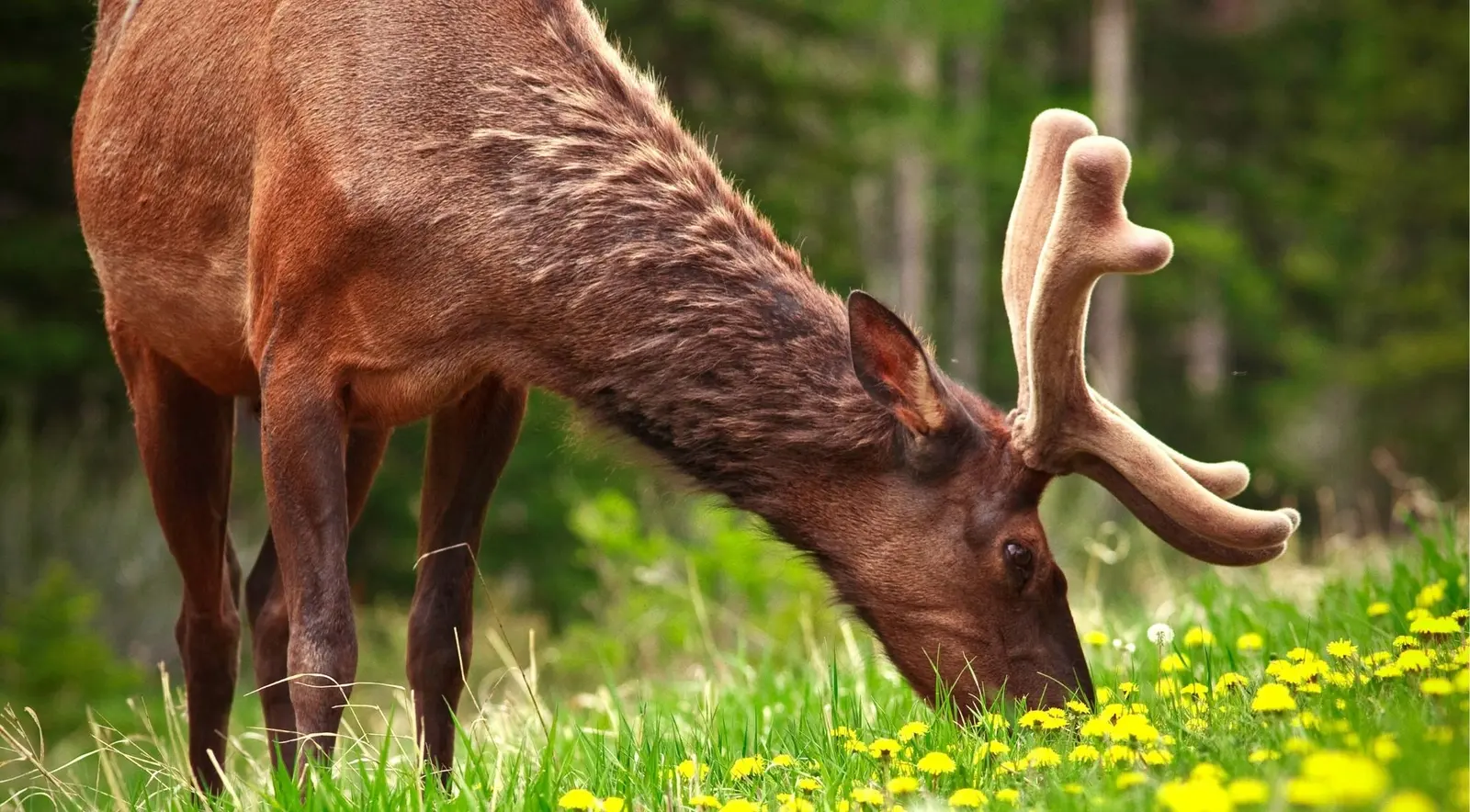
A bull elk grazing beside a quiet wildlife-viewing road in Banff National Park
Best places to see wildlife in Banff · Road-by-road guide · 2026

Best Places to See Wildlife in Banff: The Complete Wildlife Drives Guide

There's a reason you can see a bull elk from a paved pull-off in Banff, and it isn't luck. Banff's wildlife and Banff's roads occupy the same narrow strip of ground — the montane valley bottom — which is why the sightings are so accessible, and why Parks Canada layers closures and speed limits over these same few roads. This is a road-by-road guide: where to park, what you'll see, and when to arrive.

Free to drive with a park pass Dawn & dusk are best
  • 9 roadsWildlife drives covered here
  • Dawn & duskWhen animals actually move
  • 30–100 mLegal distance from wildlife
  • 44 structuresWildlife crossings on the Trans-Canada
  • $12.252026 daily adult park pass
Start here · three rules that matter more than location

Three Rules That Beat Knowing Where to Go

Banff's roads run through the warmest, most productive, earliest-to-thaw habitat in the park — the montane valley bottom — which is exactly where every highway, railway and townsite got built too. That overlap is the whole story of roadside wildlife viewing here. Before the road-by-road list, three things matter more than which drive you pick.

Check live availability and prices on GetYourGuide. Pоwered by GetYourGuide.
Rule 1

Time of day beats everything

Elk, deer, moose, bears, wolves and coyotes are crepuscular — active in the low light around dawn and dusk. A drive that shows you nothing at noon can be full of animals at 6am. If you take one thing from this guide, take that.

Rule 2

Drive slowly

The posted limits — 30km/h on Vermilion Lakes Drive, 60km/h on the Bow Valley Parkway — exist because animals step onto the road without warning. They're also the only speed at which you'll actually spot anything.

Rule 3

Stay in your vehicle

Your car is your best hide and your best protection. Animals behave naturally around vehicles in a way they don't around people on foot, so sightings — and safety — both improve when you stay inside.

The dawn classic · 5 minutes from town

Vermilion Lakes Drive

A 4.3km dead-end road beside three shallow, spring-fed lakes just west of the townsite — one of the richest wetland habitats near Banff.

From downtown, head north on Banff Avenue, onto Lynx Street, continue onto Mount Norquay Road, and take the signed left just past the Banff sign, opposite the Fenlands Recreation Centre. It's open year-round in daylight hours and plowed to the First Lake in winter. Speed limit is 30km/h — and between cyclists, runners and paddlers, you won't reach it anyway. What you'll see: elk graze the shoreline meadows at dawn and dusk, and mule and white-tailed deer are common. Beavers and muskrats work the reeds and build visible lodges. Ospreys, bald eagles, great blue herons, loons and buffleheads all breed or hunt here — over 100 bird species recorded. Photographers occasionally catch a moose on the docks at first light, and coyotes hunt the margins.

When to go: sunrise, without question — arrive 30 minutes before. The classic shot is Second Vermilion Lake looking east to Mount Rundle, which catches the first pink light while the water is still glass. The winter secret: warm spring inflow keeps parts of the Third (farthest) lake ice-free through the coldest months. That open water concentrates waterfowl, elk and coyotes when the rest of the valley is frozen solid — the best winter wildlife spot within a five-minute drive of Banff, and almost nobody knows it.

Parking is limited and congested on summer weekends — another reason to go early. There's no Roam service; cycling from town is about 2.4km via the Fenland Trail.

Worth adding to your route

Other Experiences You Might Enjoy

Most visitors pair a self-drive wildlife route with the region's headline scenery.

A wildlife drive pairs naturally with the rest of the Canadian Rockies: a sunrise trip to Moraine Lake or Lake Louise, a walk through Johnston Canyon, a boat cruise on Lake Minnewanka, a day up the Icefields Parkway to the Columbia Icefield, or a guided wildlife safari out of Banff or Canmore if you'd rather have a spotter doing the looking. The live options below update automatically for available experiences in and around Banff National Park, Lake Louise and the Bow Valley.

Bighorn sheep, near-guaranteed

Lake Minnewanka Loop

A roughly 24km loop northeast of town, signed off the Trans-Canada — the most consistently productive drive in the park.

The loop sits on the edge of one of Banff's core grizzly areas and threads two wildlife corridors. The stops, in order: Cascade Ponds (picnic area, mountain reflections, elk in the surrounding meadows) → the Johnson Lake turnoff → Two Jack Lake and Two Jack Lakeside → the Lake Minnewanka day-use area and dam → Lower Bankhead (a 1.1km interpretive trail through a coal-mining ghost town that closed in 1922) → Upper Bankhead.

The money stretch is the road between Two Jack Lake and Lake Minnewanka, particularly around the dam and spillway. Resident bighorn sheep congregate here on the shoulders and cliffs, partly drawn to grit and minerals on the roadway — they will stand in the road. Give them room, never feed them, and don't get out. Elk work the Cascade meadows near the ponds, mule deer and coyotes are regular, and wolves cross the ice on Minnewanka in deep winter — rare, but it happens.

The seasonal closure: from roughly mid-November to mid-April, the western section of the loop — from the Lake Minnewanka parking area past Bankhead — closes to vehicles as a wildlife corridor. Cascade Ponds, Johnson Lake, Two Jack and Minnewanka all stay reachable via the eastern section; you just can't complete the circuit. Parks Canada's table lists this as "November to May" — check current dates before you go.

Parking is extremely limited June through September. Go early, go late, or take Roam Route 6 (seasonal), about 25 minutes from downtown with stops at Cascade Ponds, Johnson Lake, the Two Jack campgrounds and Minnewanka.

The premier wildlife corridor · if you drive one road, drive this

Bow Valley Parkway (Highway 1A)

The original 48km route between Banff and Lake Louise, running parallel to but far quieter than the Trans-Canada. Speed limit 60km/h.

Here's the detail that explains everything: the Bow Valley Parkway is unfenced. The Trans-Canada is fenced on both sides for 82km; the Parkway isn't, so animals move freely to and across it. Combine that with low elevation, montane forest, meadows and riverside marsh, and you get the best wildlife road in the Rockies.

The stops, westbound: Fireside Picnic Area → Backswamp Viewpoint (marshy Bow River overlook, good for waterfowl and scanning) → Muleshoe Picnic Area (montane forest and old-growth aspen beside Muleshoe Lake, backed by the 1993 Sawback burn — burns regrow fast and pull in bears, sheep and elk) → Johnston Canyon → Moose Meadows (scan the treeline at first light) → Castle Junction → Storm Mountain Viewpoint → Baker Creek → Protection Mountain Campground → Morant's Curve → Lake Louise. Expect elk, deer, black bears, grizzlies, wolves, coyotes and the occasional moose — morning and dusk, overwhelmingly.

The restrictions you must check apply to the eastern 17km, from just east of Fireside Picnic Area to just east of Johnston Canyon Campground. An overnight travel restriction closes it to all travel — vehicles, bikes, pedestrians — 8pm–8am, 1 March to 25 June 2026, to protect grizzlies and wolves at a critical season. (Some tourism sites quote 6pm–9am; the Parks Canada figure is 8pm–8am.) A separate daytime vehicle closure for cycling restricts vehicles only — bikes and walkers welcome — 8am–8pm, 30 April to 25 June and 1 September to 6 October 2026 (the programme is approved through 2030). During that daytime closure, reach Johnston Canyon by car via Castle Junction, or park at the Banff train station and cycle in.

Parks Canada also periodically imposes an enforceable 1.5km no-stopping zone between Baker Creek Chalets and Protection Mountain Campground when grizzlies feed along the valley bottom and rail line. It's declared as needed, usually spring and early summer, and marked with signs — watch for them. Roam Route 9 (seasonal) serves Johnston Canyon via Castle Junction.
Big country, thin coverage, spectacular payoff

The Icefields Parkway (Highway 93 North)

232km from Lake Louise to Jasper — a full-day undertaking, with wildlife spread over long distances but definite hotspots.

Working north: Herbert Lake and Hector Lake (waterfowl) → Bow Lake and Num-Ti-Jah Lodge (a documented grizzly spot in season) → Peyto Lake → Mistaya Canyon → Waterfowl Lakes (Upper and Lower — the park's best moose area, especially Upper Waterfowl in spring and summer) → Saskatchewan River Crossing and the Big Bend (bears and bighorn sheep; sheep regularly graze the shoulders of the hairpin) → the Weeping Wall, Parker Ridge and Wilcox Pass (an 8km return hike, not a drive, but the most reliable place on the whole route for sheep and mountain goats) → the Columbia Icefield → Tangle Creek (goats). Mineral licks along the parkway draw mountain goats right to the roadside.

Logistics matter more here than anywhere: the only fuel is at Saskatchewan River Crossing, and it's seasonal (typically closed November–April) — fill up in Lake Louise. Cell coverage is essentially nonexistent, so download offline maps. Winter tires or chains are legally required 1 November to 1 April. Parks Canada closes sections for avalanche control during and after storms, usually for a day or two, and there are numerous marked avalanche no-stopping zones where you must keep moving. Check 511.alberta.ca before you leave.

Four more corridors worth knowing

More Wildlife Roads & Corridors

Switchbacks, a golf course, a burned valley, and the fenced highway that started it all.

Mount Norquay Road

Tight switchbacks climbing about 320m from the edge of Banff to the ski area — one of the most reliable bighorn sheep spots near town, grazing the meadow by the stone-walled lookout partway up and wandering onto the road itself. Mule deer are common, and locals report elk and the occasional bear. The lookout delivers a sweeping free view over the Bow Valley, Vermilion Lakes, Mount Rundle and the town, best in the golden hour before sunset. Drive it slowly — steep, sometimes loose gravel, and a sheep can appear without warning. Generally open year-round.

Banff Springs Golf Course Loop

A one-way loop road circles the Fairmont's golf course between the Bow and Spray rivers. The resident elk are so established the course has a local rule permitting you to replay a ball that strikes one. Elk concentration peaks during the September rut, when bulls bugle and herd cows — keep well back, as rutting bulls are genuinely dangerous and this is the single most likely place in Banff to have a bad encounter with one. The Golf Course Road closes to vehicles 1 November to 1 May to protect the Rundle wildlife corridor, used by wolves and cougars. Nearby, Bow Falls (year-round) and Surprise Corner both sit in elk and deer country.

Highway 93 South (Kootenay Parkway)

From Castle Junction, Highway 93 South climbs over the Continental Divide at 1,640m into Kootenay National Park. The defining feature is fire — large wildfires, notably the 2003 Tokumm–Verendrye fire that burned over 17,000 hectares, plus fires in 2017 and earlier, opened huge tracts of valley that regrow with grasses, fireweed, berries and young trees, pulling in elk, deer, bears and goats. Stops include Marble Canyon, the Paint Pots, Numa Falls and the Kootenay Valley Viewpoint. Grizzlies and black bears are frequent, especially in spring, so Parks Canada repeatedly imposes a seasonal no-stopping zone — in recent years an 11–15km stretch near Olive Lake, first introduced in 2014 after a grizzly and cubs caused traffic chaos. Penalties run from a $115 ticket to a mandatory court appearance and a $25,000 maximum fine. If you see a bear in a no-stopping zone, don't stop.

The Trans-Canada & the wildlife crossings

You won't see much wildlife on the Trans-Canada itself — it's fenced with 2.4m wire on both sides, and you can't stop on it. What's remarkable is what the fencing connects to: six wildlife overpasses and 38 underpasses, 44 structures across the 82km fenced section from the east gate to the BC border, completed in January 2014. Per the Yellowstone to Yukon Conservation Initiative, the system has reduced wildlife-vehicle collisions by more than 80% overall and by 96% for elk and deer specifically, and cameras have documented over 250,000 wildlife crossings since monitoring began in 1996 — what researcher Tony Clevenger calls the largest highway mitigation complex in the world. The overpasses look like broad, vegetated bridges arching over the highway — visible at speed, but with no pull-offs and closed to the public. Appreciate them and keep driving.

Off the obvious list

Local Spots the Guidebooks Miss

A thermal marsh, a snail found nowhere else on earth, and a correction to a piece of outdated advice you'll still see repeated online.

Cave and Basin marsh & the Marsh Loop

The genuinely unique one. Wetlands here are warmed by hot springs flowing off Sulphur Mountain, so the marsh stays open and unfrozen all winter — Parks Canada describes it as an oasis. Around 80% of Banff's bird species turn up here at some point, alongside elk, deer, coyotes and garter snakes. It's also the only place on earth you'll find the endangered Banff Springs snail (Physella johnsoni), a tiny air-breathing mollusc designated threatened in 1997 and uplisted to endangered in 2000 — the first living mollusc so classified in Canada. Only a few thousand exist, and its habitat is legally protected, so don't touch the water or enter the springs. Introduced tropical aquarium fish — mosquitofish, sailfin molly, jewelfish — also survive outdoors year-round in the warm water, a novelty that contributed to the extinction of the endemic Banff longnose dace. The Marsh Loop runs about 3.4km of boardwalk and trail, with a fish-viewing platform and a bird blind.

Fenlands Trail & Forty Mile Creek

A flat forested loop beside Vermilion Lakes — birds, deer, beaver sign. An easy add-on to a dawn drive, and the cycling connector into Vermilion Lakes Drive from town.

Tunnel Mountain Drive & the Hoodoos Viewpoint

A short scenic loop with the Surprise Corner view and the Hoodoos overlook. The surrounding slopes are important winter range for elk, deer, coyotes and occasionally bears. The main section closes to cars in winter as habitat for cougars, wolves and coyotes.

One correction worth making

The old Buffalo Paddock, a drive-through bison enclosure west of town that operated from 1897, no longer exists. Following the 1996 Banff–Bow Valley study, which identified it as a barrier to wildlife movement, the enclosure and its bison were removed in 1997. Plenty of outdated sources still list it. Don't confuse it with the separate 2017 bison reintroduction, which released wild plains bison into the remote Panther Valley — backcountry only, reachable on a multi-day hike, not a visitor attraction.

Put it together

Two Routes to Actually Drive

If you only have one dawn and one dusk in Banff, here's how to spend them.

Dawn route (first light, roughly 5:30–8:30am in summer)

Vermilion Lakes for sunrise on Rundle and early elk → Minnewanka Loop counter-clockwise, scanning Cascade meadows for elk and the Two Jack–to–dam stretch for sheep → if time and seasonal restrictions allow, onto the Bow Valley Parkway before the Johnston Canyon crowds.

Dusk route (last two hours of light)

Bow Valley Parkway westbound — Muleshoe, Moose Meadows and the open stretches near Castle Junction are best. Or, in summer, the golf course loop for elk (superb in the September rut), finishing at the Mount Norquay lookout for golden hour, or back at Vermilion Lakes for sunset.

Want better odds than self-driving?

A Guide Adds Spotting Scopes, a Radio Network, and Today's Sighting Reports

Self-driving these routes at dawn works — but a guide materially improves both your odds and what you understand about what you're seeing.

Our top pick · 95% sightings

From Banff: Banff Wildlife & Scenic Highlights Premium Tour

From $105 ★ 4.4 (285 reviews) Free 24-hour cancellation

Your guide builds each day's route around recent wildlife reports and the weather, working the same corridors covered in this guide — Lake Minnewanka, Two Jack Lake, Bow Falls, Surprise Corner — with a maximum of 12 guests and a panoramic-window vehicle.

Check availability & prices

Free cancellation. Small group, 95% sightings. Secure booking via GetYourGuide.

Know before you go

Practical Logistics & the Rules

Park pass, parking, transit, what to do if you hit an animal, and the legal distances that apply on every road above.

Park pass

Required whenever you stop anywhere in the park, and to drive the Bow Valley and Icefields parkways even without stopping. You can drive straight through on the Trans-Canada without one; any stop requires it. For 2026: $12.25 adult, $10.75 senior, free under 18, $24.50 family/group (up to seven in one vehicle). Annual Discovery Pass $83.50 adult / $167.50 family. Admission is free for everyone from 19 June to 7 September 2026 under the Canada Strong Pass; fees resume 8 September.

Parking

Fills earliest at Lake Minnewanka, Johnston Canyon, Vermilion Lakes and Morant's Curve. Arrive before 9am or after mid-afternoon, or park at the train station or Bear Street Parkade and use Roam Transit instead.

Roam Transit

Routes 1, 2 and 4 serve town areas; Route 6 (seasonal) the Minnewanka Loop; 8X to Lake Louise; Route 9 (seasonal) Johnston Canyon. No service to Vermilion Lakes or up the Icefields Parkway. Route numbers and seasons change annually, so confirm before you rely on one.

If you hit an animal

Report it — even with no vehicle damage — to Banff Dispatch, 403-762-1470, 24/7. Giving the exact location lets staff help injured animals and clear carcasses before they draw scavengers onto the road. In Kootenay, the Resource Conservation Office is 250-347-9361. The same number takes reports of bear, cougar, wolf and coyote sightings and close encounters.

Legal distances

30 metres — about three bus lengths — from elk, deer, sheep and moose. 100 metres — about ten bus lengths — from bears, wolves, cougars and coyotes. Never approach, crowd, surround or follow an animal; if it changes behaviour because of you, you're too close. Use a zoom lens, not your feet.

Stopping etiquette

Where stopping is allowed, pull fully onto the shoulder, don't block traffic, and move on after a minute or two rather than starting a jam. Obey no-stopping zones — they're legally enforceable with fines up to $25,000. Never feed wildlife. Leave drones at home; they're prohibited in national parks.

Common questions

Wildlife Drives: FAQs

The questions travellers ask most before planning a self-drive wildlife route.

Where is the best place to see wildlife in Banff?

The Bow Valley Parkway, because it's unfenced and runs through prime montane habitat. For near-guaranteed bighorn sheep in a short drive, the Lake Minnewanka Loop. For dawn birds, elk and beaver five minutes from town, Vermilion Lakes Drive.

What time of day is best for wildlife viewing?

Dawn and dusk, decisively. Most large mammals — elk, deer, moose, bears, wolves and coyotes — are crepuscular. Midday drives produce very little.

Can I see wildlife in Banff without a tour?

Yes — every road in this guide is public and free to drive with a park pass. A guide adds spotting scopes, a radio network and current sighting intel, which meaningfully improves your odds, but self-driving at the right hour works well. Our guided vs self-driving guide compares the two in depth.

Which wildlife-viewing roads close seasonally in Banff?

The western Minnewanka Loop section (roughly November–May), the Golf Course Road (1 November–1 May), and the eastern Bow Valley Parkway (overnight 8pm–8am, 1 March–25 June, plus daytime vehicle closures for cycling in spring and early autumn). Check current dates before you go.

Do I need a park pass just to drive through Banff?

Not on the Trans-Canada if you don't stop. Yes for any stop, and yes to drive the Bow Valley Parkway or Icefields Parkway at all.

Where can I see bighorn sheep in Banff?

The Lake Minnewanka Loop between Two Jack Lake and the dam is the most reliable. Mount Norquay Road is a close second.

Is there anywhere to see bison in Banff?

Not accessibly. The old Buffalo Paddock was removed in 1997. The reintroduced wild herd lives in the remote Panther Valley, reachable only by multi-day backcountry hike.

What should I do if I hit an animal?

Call Banff Dispatch on 403-762-1470 immediately, even if your vehicle is undamaged, and give the precise location.

Want better odds?

Self-Drive Works — a Guide Just Tilts the Odds Further

These routes at dawn will get you sightings on your own. If you'd rather have someone who knows where animals were seen this morning — with a spotting scope and a radio link to other guides — a guided tour materially improves both your odds and what you understand about what you're seeing.

  • Expert local guides and daily sighting intel
  • Small groups, dawn and dusk departures
  • Free cancellation on most tours — book with confidence
Check Wildlife Safari Availability

We may earn a commission from bookings made through our links, at no extra cost to you. See our affiliate disclosure. Or start with our wildlife tours overview to work out which type suits you.